Verified Views | AVRs | Visual Impact

Accurate, compliant and compelling visuals you can trust – delivered across the UK

At Visual Horizon, we create accurate visual representations (AVRs) that clearly communicate the visual impact of proposed developments. Our verified views are trusted in planning submissions across the UK for their precision, realism and transparency.

Planning Approval

We have helped secure planning approval for a range of developments in various sectors, including Residential, Commercial, Landmark, Rural and Energy Operation.

Collaborative Process

We provide a collaborative, iterative feedback process, ensuring all stakeholders have the opportunity to review and refine the visual representation of their project.

On-Time Accuracy

We understand and respect the time constraints placed on a visualiser, usually being the final cog in the machine. Our experience has allowed us to deliver everything we offer, in the fastest time possible, without sacrificing on quality or accuracy. 

A townscape photo on a road used as a baseline for a verified view A rendered (AVR3) verified view of a proposed scheme with brick and white. Includes landscape and proposed tree planting.
Complete Solution

Our experience spans across every aspect of the process – from view selection and photography coordination to delivering precise visualisations and robust documentation, all in line with the latest guidance.

Verified views
Balanced Precision

This balance is achieved through open communication and close collaboration with architects and planning consultants, allowing us to deliver a final product that is both visually compelling, technically compliant and built to withstand scrutiny.

Verified views

We deliver high-quality AVRs tailored to planning requirements, methodology standards, and your project goals.

Based in the South West, with established connections across London, the South East, Wales and the West Midlands, and supporting developments throughout the UK.

A verified view baseline photo for a proposed solar farm. Includes winter and summer. A verified viewing showing a proposed solar farm. Includes year 01 vegetation, year 15 vegetation, winter and summer versions.
An aerial drone photograph of a British countryside An aerial drone photograph of a British countryside with proposed BESS and solar 3d rendered and composited in

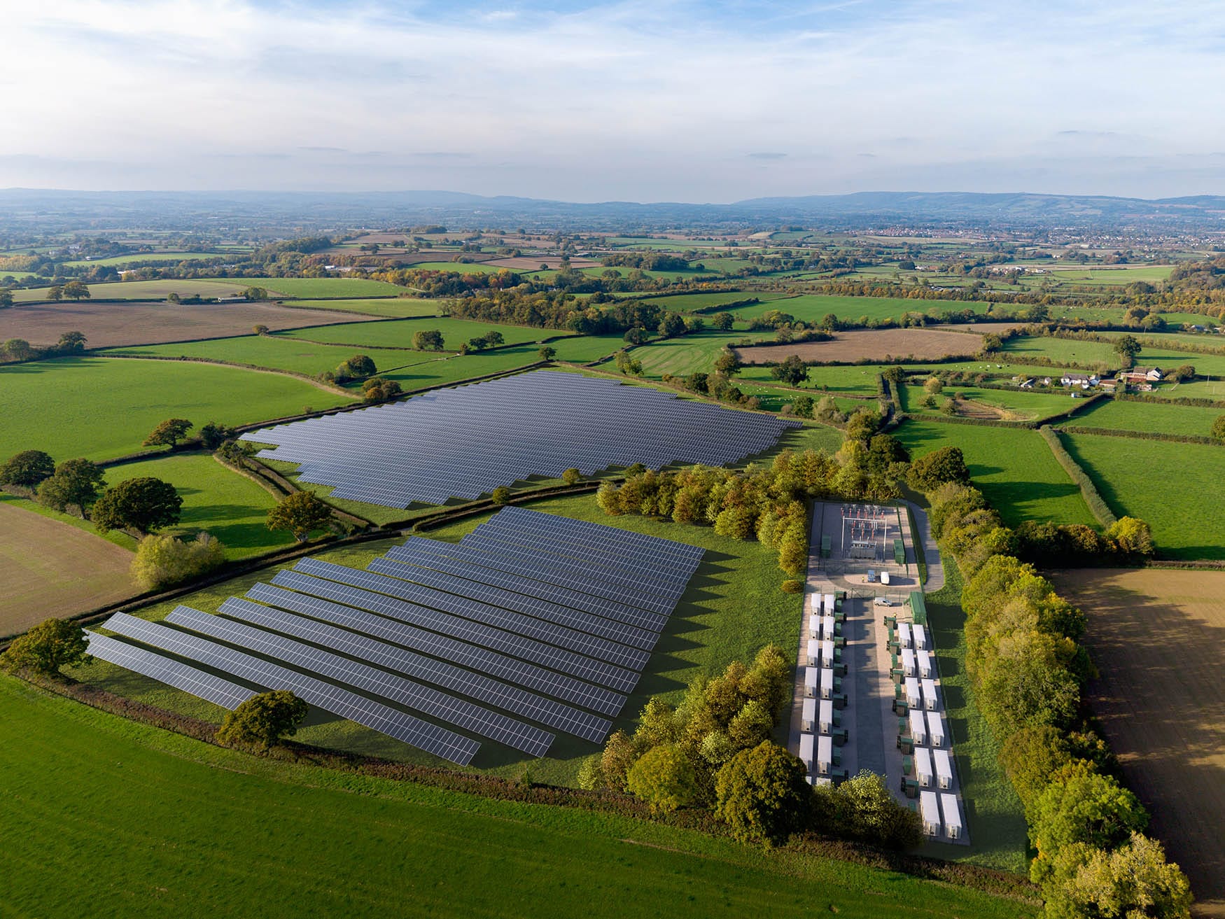
Verified Views offer a unique opportunity to accurately assess the visual impact of a proposed scheme.

A Verified View combines high resolution photography with CGI, using a robust methodology that is compliant with The Landscape Institute – Visual Representation of Development Proposals. It is the precise accuracy and verifiable process that sets Verified Views apart from a traditional Photomontage or CGI.

These Accurate Visual Representations support planning applications, including LVIA, TVIA, public inquiries, and planning committees

A river side photo used as a baseline for a verified view A rendered (AVR3) verified view of a proposed scheme on a river side. Includes landscape and proposed tree planting.
A wireline (AVR1) verified view of a proposed scheme in a town setting, on a bridge, next to a river. Alternative view (VP01) A rendered (AVR3) verified view of a proposed scheme in a town setting, on a bridge, next to a river. Alternative view (VP01)

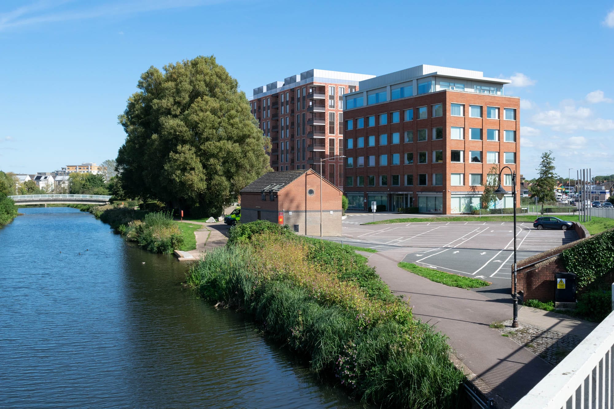
Verified Views play a crucial role in planning applications, due to the precise accuracy at every stage of the process 


Verified Views accurately simulate positioning, alignment, lighting, and materials, providing a factual basis for assessing a proposed scheme’s visual impact without subjective interpretation.

They can incorporate hard and soft landscapes, vegetation, extensions, and cumulative schemes. Views can also illustrate long-term vision, showing trees and vegetation at projected growth heights.

A townscape photo on a bridge used as a baseline for a verified view A rendered (AVR3) verified view of a proposed scheme in a town setting, on a bridge. Includes an extension and a restoration of the existing building
A townscape, river side photo used as a baseline for a verified view A rendered (AVR3) verified view of a proposed scheme in a town setting, on a bridge, next to a river. Alternative view (VP01)
A townscape photo on a road used as a baseline for a verified view A rendered (AVR3) verified view of a proposed scheme with brick and white. Includes landscape and proposed tree planting.
Scroll to Top